Category: Parks & Green Space (Page 5 of 6)

Reinventing Capital Boulevard – Northern Gateway into Downtown Raleigh

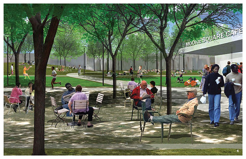
The kickoff public meeting for the Capital Blvd Corridor Study was held on June 24th with over 200 people in attendance, most of whom either lived in, operated businesses, or owned property in the immediate area.  The intent of this study is to reinvent this northern corridor to Downtown Raleigh and design a plan on how to redevelop this area from the near to long-term.

Following an overview of the study, participants broke into groups (8-10 people) and discussed four main topics that the Planning Department wanted to make sure it captured through public involvement:

1) Did the study boundary include all of the areas that should be under consideration for redevelopment, or were any left out?

2) What are the biggest issues that redevelopment of this area could address?

3) What are the biggest opportunities that redevelopment of this corridor could accomplish?

4) What are the biggest obstacles standing in the way of making our visions a reality?

The ultimate goal of this study is to create a list of priorities based on the final recommendations, in order to create short-term, mid-term, and long-term development goals of this area.  Eventually these will be presented to the City Council to get funding and begin action.

It is critical that other efforts of the City Planning– be integrated into this study, including both the plans for high-speed rail along this corridor (including the planned new Union Station), and the Unified Development Ordinance, which will address new zoning regulations for Raleigh.  This study will also open up the opportunities to create a “gateway” into Raleigh, including a greenway into Downtown that connects with the one just south of I-440, cleaning up Pigeon House Branch Creek (possibly creating a “river-walk” experience), enhancing landscaping along the corridor, controlling traffic patterns between downtown and I-440 in a more logical manner, and countless other opportunities. 

The next public meeting is expected to happen in September or October of this year. You can stay up to date on this topic and other development related information by subscribing at the City of Raleigh’s Planning Department site.


Report provided by Chris Roberts, DLA Representative for the Capital Boulevard Corridor / Northern Downtown Gateway. 

DLA member Leo Suarez of the Raleigh Connoisseur also attended the kick-off meeting, so you’ll also want to jump over to the Raleigh Connoisseur to read what he has to say in his recent post “What is the Future of Capital Boulevard?”


Public Leadership Group For The Moore Square Redesign

Chris Counts Studio 7 (Via Flickr)

In the summer of 2009, the city ran a few open call workshops to get feedback from residents and interested groups about the idea of making changes to Moore Square, both in the square’s design and its use. After the three meetings, all the comments received can be described as:

Attendees value openness, activity, and versatility. They also want simplicity, diversity of people, and safety. Making it accessible and interesting to everyone – adults, children, youth, people with disabilities, and elderly – is a value shared by all. Many suggested making it a place for kids since the population of families in Raleigh continues to rise……

If you would like to read more comments, raw and un-edited, go to the city’s website here.

After all this input, the city started a design competition in order to better engage the design community to help drive the accessibility, diversity, and sustainability goals that came from the public feedback. Their hopes were for someone to create a space that would:

– Create a unique public space and urban experience for the 21st century;
– Engage broad public participation throughout the process and in the future; and
– Establish the conditions to develop a sustainable economic development strategy for the Moore Square area.

In the Fall of 2009, the winner and finalists were announced. Chris Counts Studio of Charlottesville, VA won the competition and their final design can be seen here on Flickr. If you would like to see some of the other submitted entries of the competition, they are here.

What’s next?

The open ideas have been recorded and the design competition is in the books. The next step is to draft a master plan for the square based on the winning design and public feedback. This starts in August with various community representatives meeting with the design team. Those reps will be part of a Public Leadership Group (PLG) and the Downtown Living Advocates will be represented by me in those meetings over the next several months. The focus of these meetings will be to get your input into the master plan for Moore Square. Once the plan has been finalized, it will go up for review, approval, and then adopted in the future.

I’d like to ask for comments from anyone, DLA member or not, about what they think about the design and what questions they have about the future Moore Square. Please comment on this post so we can get a conversation started or e-mail me anytime at Leo@DTRaleigh.com.

Also, consider joining the Downtown Living Advocates if this topic and other future plans in downtown Raleigh interest you.

Join Us . . . DLA Greenway Bike Tour!

Did you know that Raleigh has more greenways than any other city east of the Mississippi?

Did you also know that there is a greenway route that connects Downtown Raleigh with Umstead Park?

The DLA invites all our members and friends to discover the Downtown Greenway with us.  We’ll be taking a beautiful, but often overlooked 10 mile section of the greenway that runs from Downtown Raleigh, south to the Walnut Creek Wetland Center, northwest crossing over the edge of Dorothea Dix Park, through the NCSU campus and onto Meredith College, before returning via Clark Avenue through Cameron Village and back Downtown.

The route was recently documented in a previous blog post titled, “From Downtown to Umstead, A Greenway Guide for Bikers and Runners”.

The bike tour starts at 10:00am, on May 22nd.  We’ll meet at the northeast corner of Moore Square, adjacent to the Longview Center.  Map it.

The circular route should take about 90 minutes to complete,  ending up at Sauced Pizza, for lunch in Glenwood South.

Everyone is welcome to join us, so be sure to invite your friends, and help us get the word out by posting this flyer in your building or neighborhood.

Please RSVP to admin@raleighdla.com.

See you on May 22nd!


Note: A rain date will be scheduled if necessary.


Pigeon House Branch, A “New” Downtown Raleigh Waterway

Looking down from my Glenwood South condo terrace, I see a small creek that emerges from under my building, then disappears under West Street.  

I’ve noticed the small creek before, but didn’t give it much thought until recently.  That’s when I learned that the forgotten creek – today mostly buried in giant pipes – is actually the most prominent waterway in central Raleigh. Unfortunately, it’s also the most abused.

The Pigeon House Branch flows from Edna Metz Wells Park, just down from Cameron Village, through Cameron Park down Johnson Street, into Glenwood South, across Peace Street, down through the former Devereaux Meadows, and then flows north along Capital Boulevard.

Some of you may have read the story of Devereaux Meadows, site of a former minor league baseball stadium that was featured a few months ago in the DTraleigh.com blog.

Devereaux Meadows, Courtesy of North Carolina State Archives

There is a project underway by the city to clean up the creek, but city officials are starting to think BIGGER.  Given the prominent location of the creek, running through the northern gateway into Downtown Raleigh, there is even talk of creating a “river walk”.   This idea was first mentioned last year in the vision of Dan Douglas for the Downtown’s northern gateway, now included in the gateway options under study by city planners.

A waterway / riverwalk could form an important part of the new northern gateway into the city, just as Union Station anchors the southern gateway. 

Imagine walking or riding your bike down the “new” tree-lined green space along Capital Boulevard that borders this “new” waterway, as you watch passenger trains roll by on their way into Downtown Raleigh. 

I see this vision becoming a reality in the not too distant future.  Borrowing the words of John Lennon, “Maybe I’m a dreamer, but I’m not the only one!”

From Downtown to Umstead, A Greenway Guide for Bikers and Runners

We’ve all heard about Raleigh’s extensive greenway system, but also that many many sections of the greenway have yet to be connected.  So when I attended a ceremony for the opening of a small section of the greenway near Downtown and was told by one of the engineers that you can now use the greenways to travel uninterrupted (off-street) from Downtown to Umstead Park, I was skeptical . . but it’s true!

It can be difficult to follow the greenways when they emerge onto a street without any indications if or where they continue, and with the lack of sufficient detail on city maps, it can make it almost impossible to locate connections.  So I was determined to test this engineer’s claim of being able to travel from my Downtown home to Umstead Park.  After studying the city’s greenway maps, I prepared a series of Google Earth printed maps and armed with a camera, I was off on my journey.  

Along the way I rarely encountered other bikers and did not see any runners, which confirmed my suspicion that these particular greenway sections are little known.  So if you live Downtown and you want to be able to do a nice long bike trip or run from your front door without getting into a car, I invite you to use the following combination of pictures and links to follow along the 12 mile route.

I started my trip at the intersection of Chavis Way and Martin Street.  While not officially a greenway, this is a beautiful path to follow, leading south until it crosses Lenoir Street.  Here you’ll find the start of Chavis Way, a short greenway section (0.3 miles) that ends at Bragg Street.  

Click here for a detailed guide of the Chavis Way Greenway.

The Little Rock Greenway is also relatively short at 0.7 miles and was only recently completed, providing an important connection with the Walnut Creek greenway.  (A dedication ceremony attended by the Mayor was held in February). Take the bridge on the left, just south of Bragg Street.   Directly across the street next to the Walnut Creek Wetland Center is the start of the Walnut Creek Greenway.  


At the the start of the Walnut Creek Greenway, you have the option to go either east (4 miles) or west (1.7 miles). The eastern route to the left dead ends, but the western route continues on to connect with the next greenway enroute to Umstead Park.  


Click here for a detailed guide of the Walnut Creek Greenway.


The Rocky Branch Greenway extends for 4.3 miles in a northwest direction, continuing along Western Blvd.  The safest place to cross Western Blvd is at Pullen Street, where the greenway continues through the NCSU campus along Sullivan Drive, and comes to an end at Gorman Street.

The city’s greenway maps refer to this next section as the Gorman Street Connector.  Rather than on a greenway, you will need to travel north on the sidewalk along Gorman Street for just over a quarter mile, before reaching the intersection at Hillsborough Street.  


Click here for a detailed guide of the Rocky Branch Greenway.
  

Directly across the street, at Meredith College, is the start of the Reedy Creek Greenway.  The Reedy Creek Greenway is relatively well-known and from here the trip to Umstead Park around Meredith College, over the Beltline, to the NC Museum of Art, and then alongside Reedy Creek Road to Umstead Park is a 5 mile trip.


The DLA will soon be organizing a bike tour of these Greenways, so look for the event announcement coming soon!


« Older posts Newer posts »