In 2011, the City of Raleigh received a $1.1 million grant from the federal Congestion Mitigation and Air Quality Improvement (CMAQ) program to construct at least 27 miles of marked, on-road bicycle facilities.
Karen Tam
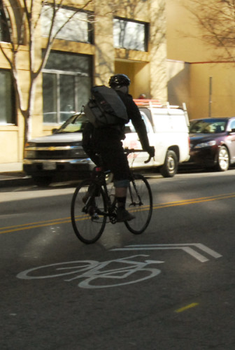
The city will soon be adding a number of new bike lanes
In an email released on November 6, the City of Raleigh’s Office of Transportation Planning announced that the design phase for the 30 projects planned through multiple consulting agencies is completed and construction will commence in spring 2015.
Raleigh Public Record interviewed Jennifer Baldwin, the Bicycle and Pedestrian Coordinator, to discuss the impact of the marked, on-road bicycle facilities on bicyclists, drivers, and the environment as a whole, as well as the challenges the Bicycle & Pedestrian Advisory Commission (BPAC) faced during the design stage.
On improving the safety of bicyclists and reducing the possibility of collisions between cyclists and motor vehicles, Baldwin said the pavement markings will enable “drivers to know when and where to expect bicyclists” and will help bicyclists know “where to position themselves.”
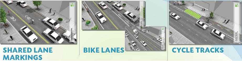
Construction on the project will begin in the spring of 2015 for three primary types of facilities: shared lane markings, bike lanes or buffered bike lanes, and cycle tracks.

According to city documents, shared lane markings “encourages bicyclists to position themselves appropriately in lanes too narrow for a motor vehicle and a bicycle to comfortably travel side by side” and “alerts motor vehicle drivers to the potential presence of bicyclists.”
The cost for implementing this construction project is low and widest-spread among those planned for the spring.
Bike lanes or buffered bike lanes increase “bicyclists comfort and confidence on busy streets,” “creates separation between bicyclists and automobiles,” and “increases the predictability of bicyclist and motorist positioning.”
While this type of construction project does allow for greater space between bicyclists and motorists, implementation will cost more for this type of project than for shared lane markings and is limited by roadway width.
The final facility that was considered during the design phase was a cycle track that “dedicates and protects space for bicyclists in order to improve perceived comfort and safety.” It “eliminates the risk and fear of collisions with over-taking vehicles” and is “more attractive for bicyclists of all levels and ages.”
It has the highest cost of the three facilities and a narrower application, as well as having the additional limitation of road width.
City of Raleigh
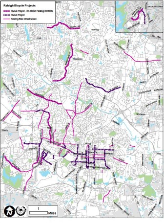
A map of the areas where the projects will be implemented
While construction will take place throughout Raleigh, the bulk of the construction will occur downtown, adding to the existing bike infrastructure.
Baldwin noted that BPAC conducted a significant public outreach program to gauge public reaction to the proposed changes and “really engaged cyclists and property owners.” Part of the public outreach program consisted of soliciting comments in affected areas by notifying people within those areas through postcards.
In 2008, a year-long planning and public input process took place throughout Raleigh for the Raleigh Bicycle Transportation Plan, which was later adopted in 2009. That led to the formation of BPAC and the later CMAQ grant.
Baldwin said the most construction would take place during evenings and weekends, that the plan will likely result in reduced emissions from vehicles as more individuals opt to bike around the city and that the facilities will create a network for bicyclists around Raleigh.