The Smoky Hollow Neighborhood
It's important to recognize the past with any project and these photos give us a glimpse into a Raleigh that is gone. The Smoky Hollow neighborhood existed before Capital Boulevard was built in the 1950's. Here are some pictures of that area around that time in Raleigh's history.
Map of the neighborhood with photo locations, past and present
View Smokey Hollow Neighborhood in a larger map
All nine photos on this page are shared courtesy of the News & Observer
Historical research by Karl Larson, History Editor, Goodnight Raleigh.
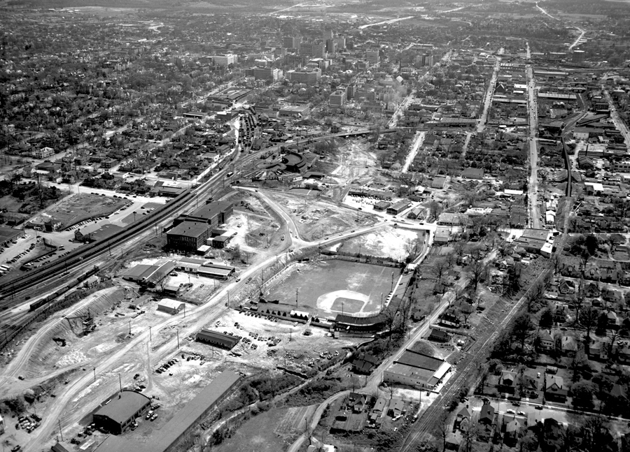
This photo shows Capital Boulevard (then known as Downtown Boulevard) under construction in 1952 or so. The project was finished in 1953. The view is looking south. This photo shows the intersection of Peace Street and Capital Boulevard. The ramps for the bridge have been graded. Devereux Meadow ballpark is in the foreground and across the left field fence is the Raleigh Cotton Mill. Across the railroad tracks from the mill is the Seaboard Passenger station. In the center is the Seaboard half-roundhouse adjacent to the rail yards. To the right of the roundhouse is Finch's with cars parked in front. To the right of Finch's is a collection of storefronts including the dry cleaning building. These are among only a handful of buildings still standing in the former Smoky Hollow neighborhood. At the right, you can see the Norfolk Southern tracks and trestles including the one that passes over Peace Street. The boundaries of Smoky Hollow were basically that area between the Seaboard railroad yards and the Norfolk Southern Railroad tracks, and between North and Peace streets.
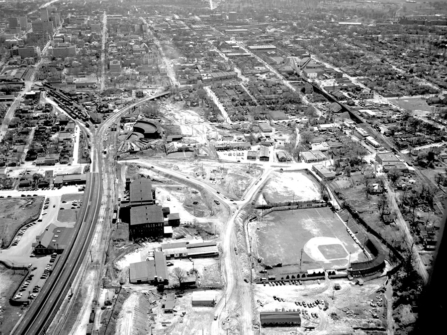
This photo shows essentially the same as the first one, only a little closer in.
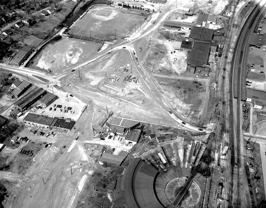
This a view of the intersection looking north. Ballpark at the top, as well as the Cotton Mill, train station, half-roundhouse, Finch's, and the laundry. That great swath of graded dirt seen at the lower left is the path of the highway.
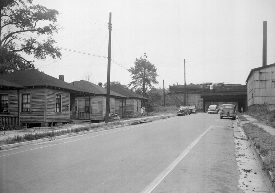
This is a view of Peace Street looking east toward the Seaboard RR bridge (replaced by the current bridge in the 1960s). Gotta love that steam engine! Those houses on the left were located where Jersey Mike's and the boulevard north-bound entrance ramp are today.
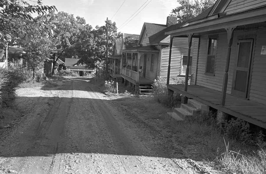
This is a view of North Harrington Street in Smoky Hollow. The houses are typical of the neighborhood. This photo was taken just before demolition for the urban renewal project began in 1960.
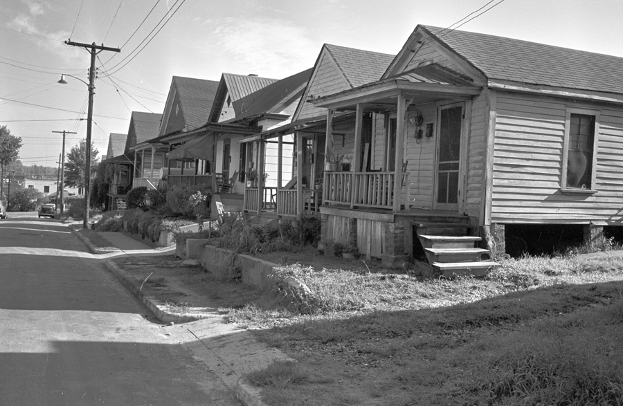
This is a view of the 500 block of North West Street looking toward Peace Street.
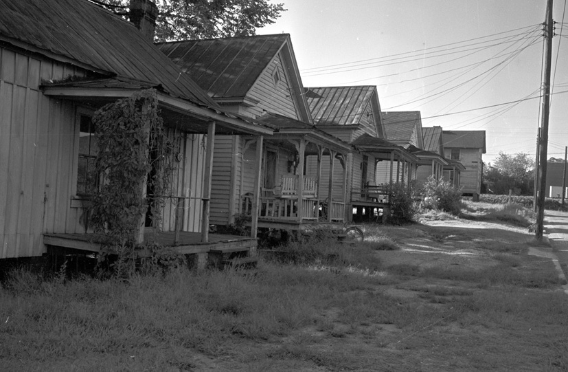
This is a view of Carey Street looking toward North Street and the Melrose Knitting Mill where the restaurant Babylon is currently open.
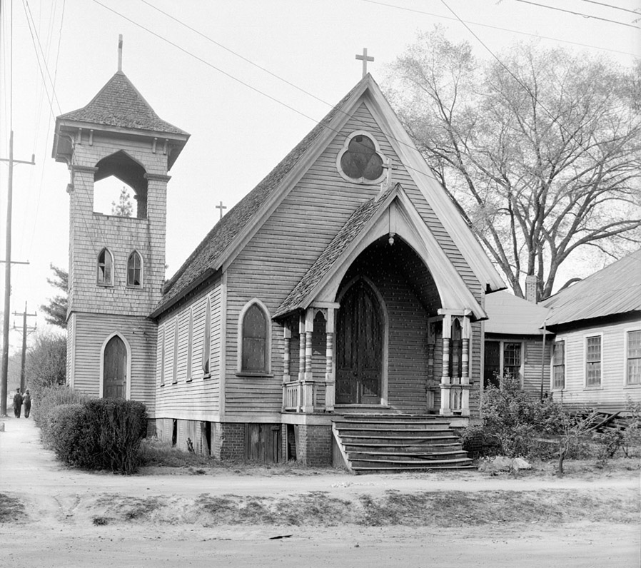
Saint Saviour's Chapel was a mission established by Christ Episcopal Church in 1891 and ministered to the railroad and mill workers in Smoky Hollow. The building was designed by AG Bauer and was located at the corner of Johnson and West Streets. It was demolished during urban renewal in 1960 and replaced by a warehouse for McCollum wholesale flowers. That building is still there.
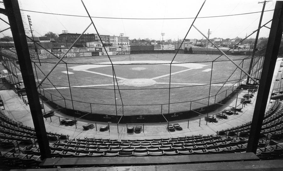
Devereux Meadow ballpark in 1963. Capital Boulevard is behind the left field fence and the old Raleigh Cotton Mill is beyond.
All nine photos on this page are shared courtesy of the News & Observer
Historical research by Karl Larson, History Editor, Goodnight Raleigh.