Brought to you by Rufty-Peedin Design Build
Wednesday, March 9, 2016
Raleigh’s Planning Commissioners met yesterday, but today’s report will actually focus on their meeting from two weeks ago. Why? Don’t worry about it. We’ll have a write-up on yesterday’s meeting next week. Deal with it.
At that February 23 meeting, the only new business Commissioners had to discuss was a rezoning case for a North Raleigh affordable housing development, Abbington Village, a project we actually covered back in January.
Z-3-16 would rezone a 9.41 acre parcel in far Northeast Raleigh at 2925 Forestville Road from R-4 to RX-3-CU, which would up the number of permitted units per acre from 3.96 to 10.64. Retail and office uses on the property would be prohibited. Abbington Village is being developed by Rea Ventures Group.
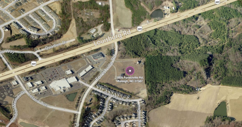
The possible site of a new affordable housing development
Matt Monroe from RVG was on hand February 23 to discuss the case with the Commissioners, explaining that the development would be a mix of one and two bedroom garden-style apartments and town homes.
As we discussed in January, several neighboring property owners expressed concerns about having an affordable housing development built in their backyard, although they were assured by RVG that the project was receiving Low Income Housing Tax Credits rather than project-based rental assistance funding for Section 8 Housing.
The developers also promised that the property would be well-maintained and that audits would be conducted sporadically to ensure the grounds are kept up.
David Watson, who lives on nearby Oak Marsh Road, spoke out February 23 against the development, citing concerns that touched on everything from a loss of the view from his backyard to drastic increase in cars and traffic.
“What we’re going to see now is a true urban jungle: parking lots, construction, rows of dumpsters,” Watson said.
“But the main thing is just cars, cars, cars; everywhere.”
He also worried that Abbington Village would have a significant, negative impact on neighboring property values.
“Once rezoning happens and construction begins, our home values will be cratered,” Watson said.
“With the stigma of affordable housing behind there, it’s gonna be next to impossible to retain value, or maybe even [impossible] to sell the home.”
Monroe said that the Timmons Group had conducted a traffic study, which found that development under the current zoning, which would be about 37 housing units, would generate an additional 36 vehicular trips in the morning and 43 in the evening to the area.
If the property was rezoned R-6, there would be an additional 49 morning trips and 62 evening ones.
Under the RX-3 rezoning proposed by RVG, which will allow for 100 housing units, there would be an additional 53 morning trips and 73 evening ones, or about 20 more morning and 30 more evening trips than if the property was developed but not rezoned.
Monroe also emphasized that Abbington Village was not going to be affordable housing in the sense that it is often perceived.
“The low-income housing tax credit program we’re working on, these are 60 percent AMI (area median income) targeted incomes,” Monroe said.
“So as far as affordable housing; it’s workforce housing, it’s not low-income housing, it’s working families, everyone has a job. The maximum monthly rents are actually fairly high.”
Monroe also cited an academic study that was itself a compilation of several academic studies which he said showed that “affordable housing doesn’t necessarily mean it’s going to ruin or crater property values.”
After some discussion of connectivity, such as the development of sidewalks, crosswalks and intersection improvements, Commissioners voted unanimously to send the case to the Committee of the Whole.
Following this vote, the Commissioners moved on to old business items, the first of which is quite old indeed: Z-34-13, a long-gestating rezoning case on Hillsborough Street. This case at 6117 Hillsborough Street would rezone a property currently designated as both R-10 and R-4 to all R-10. This would allow for a community mixed-use development; the developer. Several neighbors took issue with the case and filed a Valid Statutory Protest Petition last year.
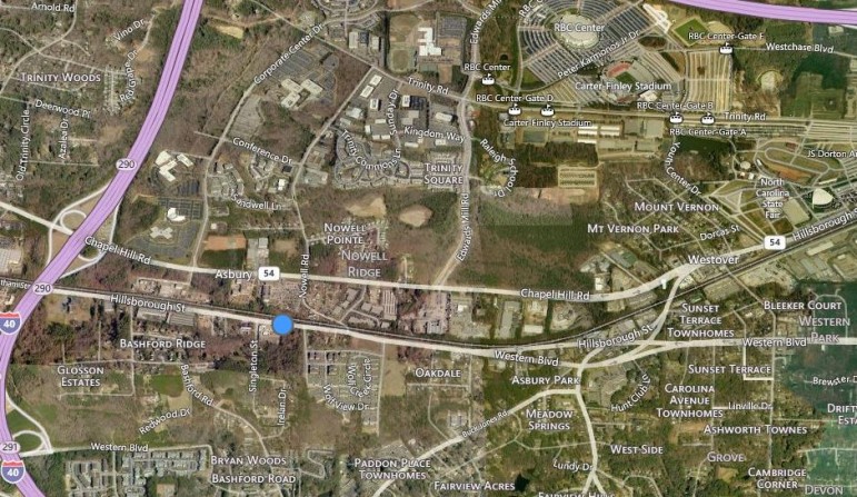
Bing Maps
The site in question is indicated by the blue dot
Commissioners had voted at their January 12 meeting to grant the project a 60-day time extension; City Council formally approved that request on January 19.
Following some questions regarding development near streams, Ben Brown from Public Works said that city regulations allows for development at 50 feet from either side of the stream, and that nutrient reduction should be prepared to deal with two and ten-year storm events.
A ten-year storm event is basically a storm severe enough that it is likely to happen once every ten years.
The applicant for the case, Nicole Toma, said they would be willing to design the site to accommodate a 25-year storm, adding that the buffer would not have a visual impact on surrounding neighborhoods.
A handful of neighboring property owners expressed concerns over drainage and the potential for flooding; Toma said the 25-year storm plan should help to alleviate these potential issues.
Chairman Steven Schuster proposed a “final deferral” of the case until March 8, at which point they will finally cast a vote. This means something happened with the case at yesterday’s meeting, and you’ll have to tune in next week to find out what. Talk about a nerve-wracking cliffhanger.
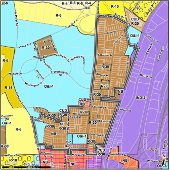
City of Raleigh
Z-2-16
The final case heard at the February 23 meeting was Z-2-16. The case would designate the Glenwood-Brooklyn neighborhood in central Raleigh as a Historic Overlay District. Located off Glenwood Avenue near Fred Fletcher Park, the neighborhood traces its roots back to the early 20th century.
According to a historic research report prepared by the city, the Glenwood-Brooklyn Historic Overlay District includes the Glenwood Historic District, which was listed in the National Register in 1985 and was expanded in 2001 to include most of the adjoining Brooklyn neighborhood.
While several residents in the neighborhood spoke in favor of the rezoning, saying it was a good way to preserve the character and aesthetic of the area, some business owners were concerned as to how the overlay district would affect them, and that it wouldn’t allow for enough density. Several property owners requested to be excluded from the rezoning.
Commissioners eventually voted to recommend approval, contingent on a report being issued to City Council regarding concerns they had regarding the property’s boundaries.
A public hearing date of April 5, 2016 was suggested, and it was formally scheduled the following week by City Council.

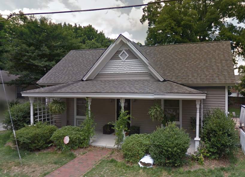
Google Maps
This house, first built in 1909, is one of the many historic homes in the district