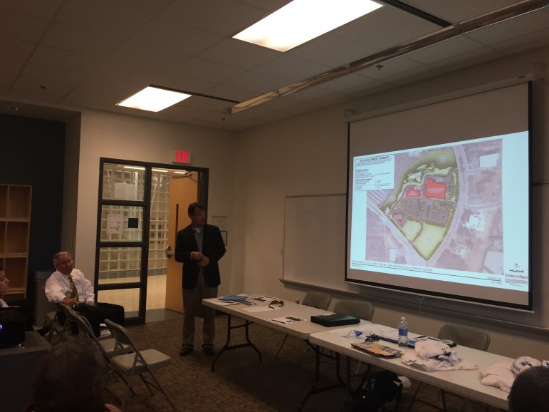
A site plan case for an undeveloped parcel of land at the intersection of Poole and New Hope road was presented as a courtesy to the Southeast Citizens Advisory Council during its July meeting earlier this month.
Richard Brown, a representative from Kimley Horn, which designed the site plan drawings for the proposed shopping center, was on hand to provide neighbors with more information about the development.

James Borden / Raleigh Public Record
Richard Brown from Kimley Horn was on hand to discuss the new shopping center at this month\’s Southeast CAC Meeting
Brown could not, however, answer the crowd’s most persistent question: which company will serve as the center’s anchor grocery store?
While many in attendance speculated that the anchor spot would be filled by a Wal-Mart Neighborhood Market, Brown would only say that the project’s developers, WRS, had a “national grocer” in mind. Wal-Mart Neighborhood Markets are scaled-down versions of the chain’s traditional outlets that often specialize in grocery items.
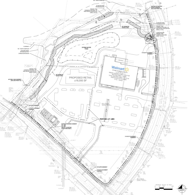
On site plan drawings for the project, SP-35-15, which are available through the City of Raleigh, the anchor grocer is identified as a Wal-Mart Neighborhood Market.

City of Raleigh
These site plan drawings show a Wal-Mart on the site, although the developers have not confirmed this
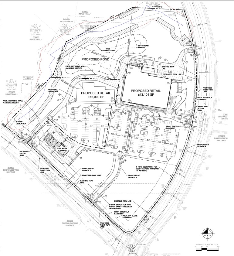
Brown said the proposed development would encompass about 60,000 square feet of total retail space, which would include the proposed 43,000 square-foot anchor grocery store and an adjacent 16,000 square-foot retail structure.
Additionally, Brown said the national grocery retailer would be adding a six-pump fuel kiosk to the site. On the site plan drawings, the fuel kiosk is situated across the 262-space parking lot from the two main retail buildings.
Adjacent to the fuel kiosk sit two additional lots, .92 and 2.13 acres in size, which are not being developed as part of this current plan. Brown noted that a sidewalk leading to the new development would be built between these two lots, allowing pedestrians from Poole Road easier access.
Some neighbors in attendance said they would have preferred to see a grocer specializing in organic foods and vegetables be built on the site instead, but were happy that something was finally getting developed on the site.
Others expressed concerns over the potential traffic and stormwater impacts the development would have on the surrounding area.
Brown said they had worked extensively to address both of these issues.
“No additional stormwater discharge will leave the site without being treated,” he said.
The development will add 10 acres of impervious surface area to the property, which is located within the Neuse River Buffer. Mitigation efforts, Brown said, including a proposed stormwater pond, would help to curtail any negative impacts generated by the increase in impervious surface area.
To further offset this increase, the developers preserved a western portion of the site as a tree conservation area.
When addressing the concerns over increased traffic, Brown said one step the developers had taken was adding a transit easement to the site, “where the city may or may not elect to come back and build a transit structure.”
These easements, along with additional turn lanes and new sidewalks would help to minimize the effects of increased traffic in the area due to the new development.

City of Raleigh
Site plan drawings for the new shopping center
Although some protested that traffic was already problematic enough in the area, Southeast CAC Chairman Tim Sit noted that Brown and the rest of the development team were only there “out of the goodness of their hearts” and not because their plans required neighborhood approval.
Brown said the project will go before the planning commission in August, and will hopefully begin its 12-14 month construction period sometime in 2016.
