The public will soon get to view the long-awaited map that will accompany Raleigh’s new zoning code. The map will complement the Unified Development Ordinance, Raleigh’s new zoning code, which was adopted by City Councilors last year.
The zoning code has been in effect since September, but the map has yet to be released. While city planning staff has been hesitant to provide a concrete date the proposed map will be released, the first draft is expected to be out this spring. The public will have four to six months to review the draft before the Planning Commission begins its review.
“Even though the new code is more simple than the old one, it’s not simple,” said Deputy Planning Director Ken Bowers. “It still takes a little bit of work to understand.”
Bowers said the goal is to provide enough information on a special mapping website so that the public has a basic level of understanding of the changes once the conversations begin.
Bowers stressed the map is just a proposal, but one that he feels city planning staff can defend.
“We expect it to change,” he said.

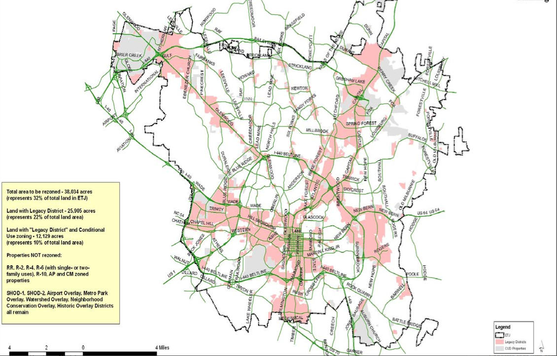
Image provided by City of Raleigh
A map showing the areas that will be changed for the UDO, with legacy districts shown in pink.
What’s Changing
Bowers said many residents likely won’t notice a difference. Those who may see changes are those who own income-producing property, such as a shopping center, or live in a high-density multi-family building such as a condominium.
Most of the residential zoning districts have already moved over to the new code, but some, like shopping center, office and institutional, and denser residential districts, don’t translate directly to the UDO. This amounts to about one-third of the city that needs a new designation.
The public will also be introduced to frontages.
A frontage is how a building addresses the street and is intended to give the area a specific look or preserve the character of a neighborhood.
Bowers said that frontages won’t be mapped throughout the entire city, only where they would be appropriate. 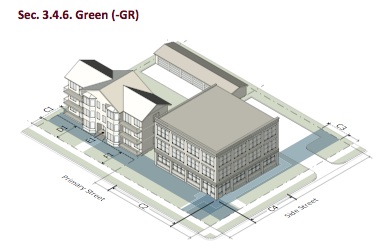
An example of where frontages would be used is in downtown Raleigh. The downtown overlay district will be removed, but the same planning goals can be achieved by using a combination of regulating height and frontage.
The UDO and the FLUM
About five years ago, the City Council adopted the 2030 Comprehensive Plan and the Future Land Use Map (FLUM).
Both provide the guidance and vision for growth and development for Raleigh. The UDO is the legal code that puts the comp plan’s elements into play.
The big difference between the two is that one is policy and one is law. The FLUM is used when property owners want to rezone their property. The map is consulted as a way to determine if the rezoning would be consistent with the vision for the area, but doesn’t have any legal value. Councilors often approve zoning applications inconsistent with that map.
The UDO map is a legal document and changes the rights and regulations associated with a piece of property.
Because of that, Bowers said that while fewer properties in the city will be affected by the remapping, the level of feedback will likely be greater than when the FLUM was proposed.
Bowers said that about 50,000 notices will go out to affected property owners and their neighbors about the potential new map designations.
What’s Next
The proposed map is expected to be released this spring. The Planning Commission will get its first crack at it about six months after the public is done reviewing it. A public hearing will be set before the City Council gets its hands on it.
Denizens can provide feedback on the map every step of the way.