City planners recently released an updated draft of the new zoning code. The new document has lots of changes, and this article is Part Two of a three-part series to explain those changes. Read Part One, read Part Two or read our previous coverage and explanations of the Unified Development Ordinance.
Raleigh’s getting a brand new zoning code. City planners have been working for more than a year to rewrite the entire zoning code into what will be called the Unified Development Ordinance.
Christine Darges with the planning department sat down with the Record to help put this complicated document into English.
What’s Next?
The public hearing for the new draft will take place Feb. 21. The Planning Commission will then have 105 days to review the docoument. After it has been reviewed by the Planning Commission, it will go to the City Council for final approval.
Darges said the councilors can keep it indefinitely. She suspects the council will hold the draft for at least three months and that a final vote will likely take place next fall.
While the draft is under public review, Darges said staff will map the new zoning code. She anticipates releasing it in the late spring or early summer. But, because of how extensive the process is, Darges said it could take another 12 to 18 months for the map to be completed and adopted.
So, What About That Map?
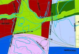
Unlike the planning process for the 2030 Comprehensive Plan, which included the Future Land Use Map, there is no map to go along with the UDO.
The mapping will be completed well after the UDO has already been adopted by the council.
Darges said because it’s a hybrid code and not a form-based code, going forward without a map was a viable option. She said staff has been using a base map during the process to see how certain areas would be impacted.
A majority of the residential districts aren’t going to be impacted. For commercial and mixed-use districts, Darges said staff was able to correlate the comprehensive plan future land use districts to the new list of zoning districts.
“You don’t want to create a zoning district where the Future Land Use Map can’t be used,” she said. “Then you have those inconsistencies that we have today.”
Also, during the comprehensive plan process, citizens were so focused on the map that the text went virtually unnoticed, Darges said, adding that the city wants to put more focus on the text of the code.
“People were so fixed on the map, there wasn’t enough attention on the text through the public vetting process,” said Darges. “We feel that if we put the right rules in the right places then we don’t need to have the map.”
Darges said that the mapping process will be an intensive public process that will include a lot more discussion with property owners.
“We feel strongly that we have the right regulations and the right palette of zoning districts and the right frontages to make that implementation of the map happen after the text adoption,” she said, adding that the development community already wants to utilize the new standards.
Until the map is adopted, there will be two codes running at the same time, but Darges said staff is okay with that.
