City Council met Tuesday after swearing in three new councilors the previous night to discuss a number of zoning and development related issues.
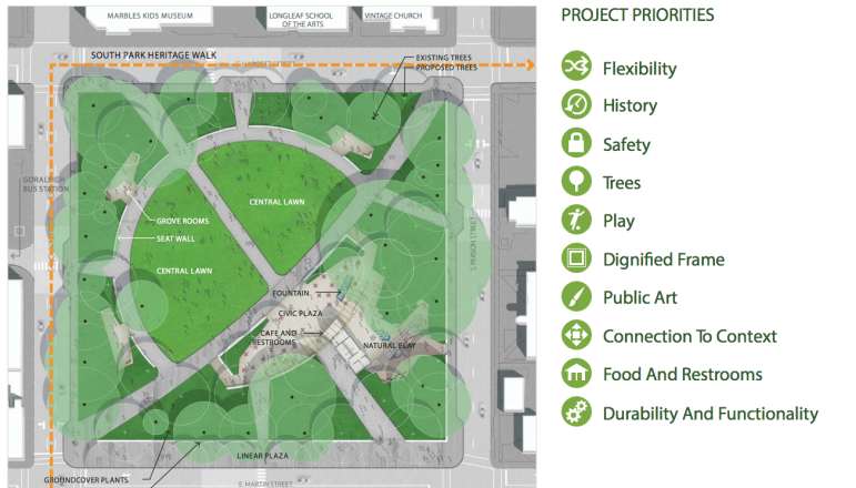
A presentation was given on the schematic design of Moore Square. It concerned the 15 percent schematic design, which had been presented to local residents. A member of Sasaki, the design team, made the presentation to councilors.
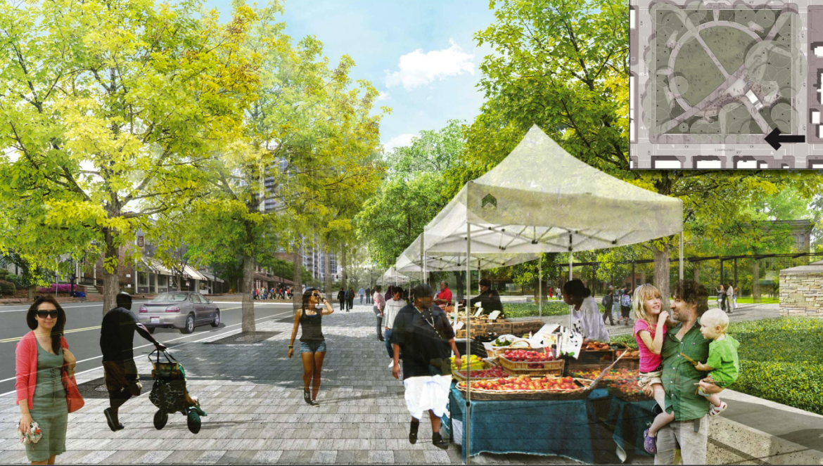
Current plans for the redevelopment of Moore Square
The history of the square was said to be an important part of the design process. Trees were looked at as critical for the plan. The site would be imbued with the South Park Heritage Walk. A flexible lawn would allow for a variety of events. Community feedback stated that residents wanted to see Moore Square as a place for smaller, everyday events rather than just big events.
The presentation focused on the architecture that would be built during the remaking of the park. Community residents said they would prefer an indoor-outdoor component on a human scale, to allow for interactivity within the park. Sasaki said that the architecture would be a hub point for the park, located in the southeast portion.
Councilor Stephenson raised the question of the upkeep required for a number of years. Staff said that with every new park comes an operational analysis that allowed for how much the upkeep would cost and how it would affect the budget down the road.
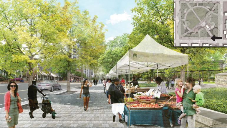
A rendering of Moore Square
A pair of rezoning cases, Z-34-15 and Z-35-15, were referred to the comprehensive planning committee.
They concerned adjacent properties that are currently zoned residential-4. The proposed rezoning would be to residential-10-conditional use. Both cases were found to be inconsistent with the future land use map and comprehensive plan. The planning commission recommended approval by a 6-1 vote and the Midtown Citizens Advisory Council also recommended approval.
City of Raleigh
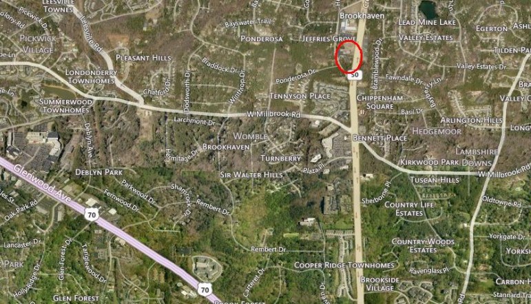
The are encircled in red is where Z-34 is proposed
The future land use map represented the two locations as low density residential, according to Bynum Walter in the planning department. She added that the expectation for more open space than the proposed development expected. Councilor Thompson advocated for a closer look at the two cases before making a decision.
The Enterprise Land Management software implementation was approved by Council Tuesday. The item concerned the need for the city to have an overview of development information. This new software implementation would phase out old “legacy” systems and implement new software that would promote efficiency in the long run. Councilor Crowder asked about the cost of buying and maintaining the software. Staff said the upgrades were included in the ten-year cost not to exceed $9,716,857. The cost also covered a public portal.

A very dangerous dog
In other business, revisions to the dangerous dog ordinance were referred to the city council session in January. The revisions clarified terms, such as “dangerous dog,” and defined terms such as “provocative” and “serious injury.” The appeal process, the city attorney said, would be streamlined, eliminating the dangerous dog committee that existed for such appeals. Councilors Stephenson and Crowder indicated seeing the revisions in a forum to allow for more questions.