The planning commission met Tuesday to decide on numerous rezoning cases and text amendments.
TC-4-15 was a text change that concerned development standards within the Unified Development Ordinance (UDO). One of the identified impacts of adopting this text change would be allowing rear-loaded garages to be located four feet from access easements. The text change was sent to the text change committee for further discussion.
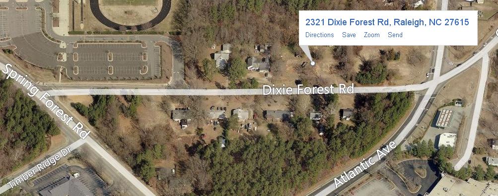
Z-7-14 concerned a 4.57 acre parcel of land at the intersection of Litchford Road and Dixie Forest Road. The proposed rezoning was to NX-3-CU, which would allow for increased residential density and increased retail and office intensities. It was found to be inconsistent with the Future Land Use Map and the Comprehensive Plan, with the main outstanding issue being the frontage.

Bing Maps
The property in question
Michael Birch from Morningstar Law Group represented the applicant and stated that they were waiting on an April 2nd vote from the north Citizens Advisory Council (CAC) before imposing additional conditions that would address the frontage issue. The item was deferred until after April 2.
Z-37-14 comprised an 8.76 acre parcel of land on Brier Creek Parkway. The proposed rezoning was to CX-7-CU, and would raise the residential density, as well as the retail and office intensities. Conditions on this property would include adult establishments being prohibited and a transit easement being offered. It was found to be consistent with the Future Land Use Map and the Comprehensive Plan.
Michael Birch, representing Davis Moore Capital, said the applicant had added a number of conditions, including a parking limited frontage due to a power line easement. The planning commission recommended approval of the rezoning.
Z-3-15 concerned a 5.4 acre parcel of land on Leesville Road. The rezoning was from R-1 to R-6, which would increase the residential density. It was found to be consistent with the Future Land Use Map and the Comprehensive Plan. The planning commission recommended approval of the rezoning and said that the rezoning was in the public interest because of connectivity and density supported by current and future needs.
CP-2-15 and CP-3-15 contained text changes that would be used to amend parts of the Comprehensive Plan. Both were sent to the strategic planning committee for further discussion.
Z-33-14 comprised a 3.65 acre property on Tryon Road. The rezoning would zone the property from residential to neighborhood-mixed-use. It was found to be consistent with the Future Land Use Map and the Comprehensive Plan. Tree conversation would take place near the back of the property to act as a buffer from I-40.
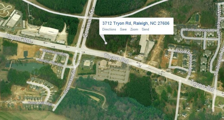
Bing Maps
Tryon Road
The planning commission recommended approval of the rezoning.
Z-34-14 concerned 1.64 acre property on Creedmoor Road. The rezoning would increase residential density and increase both office and retail intensity. It was found to be consistent with the Future Land Use Map and Comprehensive Plan.
“It’s the last piece on the block that will create a commercial corridor that will act as a buffer for the residential properties and neighborhoods nearby,” the applicant Ted van Dyke said.
The planning commission recommended approval of the rezoning.