Category: Transportation / Parking (Page 5 of 10)

Downtown investment is key to keeping taxes down while supporting Raleigh’s population growth

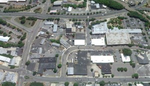
Underutilized tract of land - northeast Glenwood South

Joe Minicozzi, a new projects manager of a firm which drove the revitalization of downtown Asheville has taken his show on the road, convincing other cities:

If you’ve got underutilized buildings in your downtown, do anything you can to fix them up, because that’s where your wealth comes from.

The bottom line is that per acre, high density areas have the potential to generate much more public wealth than low-density subdivisions or massive suburban malls.  Taking into consideration the revenue they bring in, downtowns cost considerably less to maintain in public services and infrastructure.

Growth in low density development works like a pyramid scheme. 

Low density development isn’t just a poor way to make property-tax revenue, it’s extremely expensive to maintain.  In fact, it could only be feasible if we’re expanding development at the periphery into eternity, forever bringing in revenue from new construction, helping to pay for the existing subdivisions we’ve already built.

It would take 600 single-family homes on a 150-acre subdivision to equal the tax base of the 30-story Wells Fargo Capitol Center downtown.  And it sits on 1.2 acres of land.

This simple math is important for residents to understand, and particularly for those still hesitant to support investments in public transit.

Transit authorities are currently holding public forums to inform residents about the Wake County Transit Plan, and to build local support for its approval.  Improved availability of public transit is a critical part of the infrastructure necessary to encourage higher density development and attract more residents to live in urban areas like downtown Raleigh.

Higher density development downtown keeps taxes low.

This is the simple message for all those who complain that the city is investing too much inside the belt line or in downtown Raleigh.

And while Raleigh has not been as hard hit as other cities, property values and their associated tax revenues have fallen.  By utilizing the economics of land use, Raleigh can continue to grow and avoid the need to raise taxes or cut city services.


Information included in the post taken from an article posted in the online publication from <www.theatlanticcities.com>.
The Simple Math that Can Save Cities From Bankruptcy

County Transit Plan Moving Forward – Vote YES this fall

The Wake County Transit Plan is moving through the review process among the county municipalities, including a review with the Raleigh City Council yesterday.

Details of the plan are taking shape since our last update on this blog, so here’s what we know now.

The Wake County Transit Plan has been divided into two parts, with the Core Plan supported by local funding, and the enhanced plan requiring State and Federal funding.

This table shows you the What, When, and Where…

And Why . . .

The Why is fairly obvious given that the City of Raleigh and Wake County will have ANOTHER MILLION PEOPLE moving here in the next 20-25 years, who will compete with existing residents for space on roads and land (housing).

Two opportunities promise to help meet the requirements of this expanded population.
  1. We need to give people a choice of using public transit rather than their cars to avoid adding to our own personal cost and time due to major road congestion.
  2. Light Rail encourages higher density housing development around train stations, needed to provide a cost effective use of our limited land and energy resources.

Next Steps

  1. Transit authorities continue to seek input from Wake County municipalities.
  2. Final Wake County Transit Plan submitted in May/June this year.
  3. County Commissioners vote to approve referendum on local sales tax.
  4. Referendum held in November this year.
  5. Yes vote is a GO to begin executing the Core Plan.
  6. Continue to compete nationally for Federal Funds to support the Enhanced Plan.

Thank you for your support of Raleigh as it grows in accordance to the visioning of residents, businesses and local government who continue to balance growth with quality of life.  Change is inevitable, but with informed citizens, we can shape it to make Raleigh a model for connection, sustainability and vitality.

Resource Links

Peace Street Corridor: Picture a “complete street” with new park and greenway connections

Anyone who has traveled by foot, car or bike along Peace Street near the interchange with Capital Boulevard knows the difficulty of navigating this congested area.  There’s no question that it’s badly in need of a make over.  Good news!  There are plans underway to not just fix problems, but to transform this northern end of Downtown Raleigh into an attractive, vibrant place to live, work and play.

What starts with required bridge replacements over Peace Street, ends up driving a huge redevelopment opportunity with a new city park.

Here’s what’s in store.


It all starts with the North Carolina Department of Transportation (NCDOT) replacing the “structurally deficient and functionally obsolete” Peace Street bridge.  Built in 1948, the bridge is nearing its useful life, so this action is unavoidable.  A public hearing on the bridge replacement project is planned for fall 2012, with construction projected to start in 2016.

Roundabout OptionIn conjunction with replacing the bridge, there is an urgent need to rethink the the interchange with Capital Boulevard, which carries 54,000 vehicles per day, forecasted to increase to 77,000 vehicles.  Various new loops are being considered, including using roundabouts.


In reworking the vehicle interchange, the new NCDOT policy “complete streets” requires new street designs to accommodate all users, including pedestrians and bicycles.  So while pedestrians and bikers navigate this area at their own risk today, in the future they’ll be able to take advantage of the new Downtown greenway connection.   


This downtown area is set to become a link to the greenway system and hub for rail stations.

We talked about the 3-mile greenway that will connect the Crabtree Creek Greenway and the Downtown in our previous post Re-Imagining Capital Boulevard.  Here is a map of a proposed route.

This area of Peace Street is also featured prominently in the city’s rail plans, as the location for both commuter and light rail stations.  The commuter rail station is to be located at Peace Street (Seaboard), and the light rail (Government station) would be located on nearby Harrington Avenue.
   
Now consider adding a park!  


Devereux ParkDid you know that Devereux Meadows, located on the area bounded by North West Street, Peace Street and Capital Boulevard, was once a minor league baseball field?  Today the area, where development is limited by the fact that it sits on a flood plain, is used by the city to park their waste services trucks and other utility vehicles.  But the city agrees that this under-utilized area is perfect for an urban park, featuring a restoration of Pigeon House Branch waterway.  Imagine a new downtown waterway with the new greenway running alongside. 


Once transformed, the area will become a magnet for redevelopment.


This new pedestrian-friendly area with nearby transit and green space will become very attractive for redevelopment.  The Peace Street Visioning Study laid out some ideas for high density redevelopment, including the realignment of Harrington Street to intersect with Peace Street and create new development lots.


The adjacent area along the northern end of West Street is also prime for redevelopment.  In addition to running alongside the new “Devereux Park”, the City Planning Department has identified West Street to become a future north-south connector into the city and major link to Union Station.  Plans include the realignment of North West Street to favor development north of Peace Street, extending the street to Fairview Road.


And finally, we can also imagine the Peace Street Corridor transformation becoming a driver to spark the redevelopment of the adjacent area on Glenwood South’s northeast corner. We talked about this “Frontier of Possibility” in a previous blog post.

This is just one more example of how Raleigh city government, residents and businesses are shaping the quality of Downtown life.  As a resident, I look forward to walking with my granddaughters on this greenway, feeding ducks in Pigeon Creek, and popping on the light rail to have a bite of lunch.  I look at the view from my condo terrace at 510 Glenwood and feel excited about all I know is coming.

Bus Transit for Downtown Residents: Beyond the R-Line

Moore Square Transit StationOkay, so we love the R-Line for getting around the downtown core, but what if we want to do some real shopping or go to the airport?  

Like other downtown residents, you like to avoid getting in your car when you can, so maybe you’ve already considered taking the bus somewhere.  But you may assume it isn’t practical or worry you might not get where you want to go on time.


Well, if you were one of the DLA members who attended our transit event two weeks ago, you learned just how easy it is to take the bus.  For those who missed our event, here’s the good news.

Fares

Compared to driving, bus fares are extremely cheap, with one-way fares costing just a buck! It’s even less expensive to buy a 5 day or monthly pass.  You can even purchase your bus pass online

Boarding at Moore Square

Moore Square Station Transit Mall is shown on the right.  There are different boarding zones, so look for the colored pillars to learn where to stand and wait for your bus.

Shopping at Cameron Village, Crabtree Valley Mall or Townridge Shopping Center

At the Moore Square Station, line up at the Red Zone.  Using route #39, the trip to Cameron Village takes only 10 minutes, and then another 15 minutes (25 minutes total) to Crabtree Valley Mall.  Here is the outbound (from downtown) and inbound route map and schedule.  If you prefer to shop at the Pleasant Valley or Townridge Shopping Centers, the trip via route #6 takes 40 minutes.

Going to the airport

At the Moore Square Station, line up at the Purple Zone.  The bus stops at both airport terminals and takes only 30 minutes.  Here is the route map and schedule.


New Technology for real-time tracking is here, and more is COMING SOON.

Many downtown residents enjoy the free smartphone App to get real time tracking of the R-Line bus.  And this same tracking is also available TODAY for all CAT and Triangle Transit Bus routes.  For tracking on the go, you can download the iPhone App here.

But it’s going to get even better.  Real-time bus route information will soon provide predictions of bus arrival times at any stop. This information is sent to digital signs at some stops, but is also available by text message and on the web. 

Want to learn more? Read the CAT Riders Guide FAQ, or contact Kathy Molin, TDM Coordinator for the City of Raleigh at katherine.molin@raleighnc.gov, ph: 919-996-4036 

Additional links:


Calling Walkers, Bikers, and Commuters! Vote YES for Raleigh’s Transportation Bond on October 11

The Raleigh City Council is asking Raleigh voters to approve a $40 million transportation bond, placing the bond proposal on the October 11 municipal election ballot. This is Raleigh’s first Multi-Modal Transportation Bond that includes funding for a rail transit hub, upgrading Moore’s Square Transit Center, transit benches and shelters, greenways, bike lanes, streetscapes and sidewalks.  

These new projects and improvements to the public transportation network are critical to the ongoing revitalization of Downtown Raleigh.  

The DLA encourages residents to spread the word to vote “Yes” for the Transportation bond.

Here’s what you should know:

Union Station: New Rail Transit Platform  

$3M in city funds would be matched by State and Federal funds totaling $20-25M to be used for the first phase development of the facility.  

The old Dillion Supply building at the west end of Martin Street in Downtown Raleigh’s Warehouse District is targeted for the new transit platform or rail hub, as talked about 3 months ago.

Moore Square Transit Facility: Transform and Renovate Facility

According to City of Raleigh Transit Administrator David Eatman, “We are talking about a total makeover.”  The improvements would include improved waiting areas and pedestrian walkways, better vehicle flow from Wilmington Street to Blount Street, and increased bus capacity.

The DLA talked to David Eatman last December about the Master Plan for the Moore Square Bus Station. Here’s what we learned.

Greenways: Connecting Existing Sections

  • Walnut Creek Extension: This is the final link in the 100+ miles of interconnected greenways running throughout the city. This section connects Walnut Creek Greenway (accessible to downtowners via the Chavis Greenway) from the Wetland Center to the Neuse River Greenway.  By the end of next year, the Neuse River Greenway will span 30 miles along the Neuse River, becoming the longest Greenway in North Carolina.  ‘Mr. Greenway’, Sig Hutchinson says, “It’s a very Big Deal!”
  • Rosengarten Greenway: The greenway would be a key connection between the Rocky Branch / Walnut Creek Greenway to the south and the Lenoir Street Park and Boylan Heights neighborhoods to the north.  Because it will connect to existing, already-popular routes, everyone who wants to use the greenway system benefits from increased connectivity into Downtown. 

Streetscape improvements 

  • South / Lenior Project: The South/Lenoir project would complete the two-way conversion of the corridor that began several years ago from S. Saunders Street to East Street.  
  • Blount / Person Corridor Planning: The Blount/Person corridor study will look at land use and transportation options for the corridor from Capital Boulevard to I-40, including segments along Wake Forest Road and Hammond Road.   

Bicycle Lane Improvements 

The Bicycle Pedestrian Advisory Commission has a comprehensive list of bike projects to complete as funding becomes available.  Downtown Raleigh, with its concentration of bike traffic is where there is the greatest need for improved access. 

Come join us at the Public Event on Oct 4th in Nash Square to rally support for the bond!

Additional information: 

Citizens Supporting Raleigh

City of Raleigh: Q&A document


Note: A separate $16M Housing Bond proposal will also be on the October 11 ballot.  The Housing Bond will be voted on separately from the Transportation Bond, and support ongoing programs for first-time homebuyers, low-interest loans to private developers of affordable apartments, neighborhood revitalization, and tornado relief assistance for low income homeowners. 


« Older posts Newer posts »